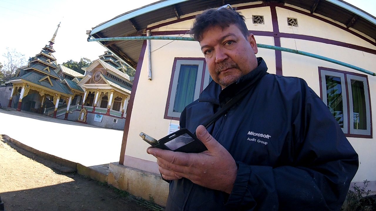
In Part 5, we continue our adventures through Chin State.
Just a few years back, It would have quite remarkable that I was even up there.
Like much of Myanmar, Chin had been closed to foreign tourists for decades. The
few that did make it up there were invariably accompanied by gov’t approved
tour guides on gov’t run travel packages. This little state, landlocked between
India and Myanmar hasn’t had many tourists until recently.
They like to paint their houses in vivid colors
Some facts about Chin State: At about 15,000 square miles,
it’s roughly the size of Switzerland. About 2/3rd the size of West
Virginia and one and half times bigger than Vermont. Whereas 8 million people
live in Switzerland and 2 million reside in West Virginia, the population of
Chin is a bit shy of 500,000. And like these other places, it’s all
mountainous. I can’t say that I saw a single bit of horizontal land in the
whole state that people hadn’t made that way.
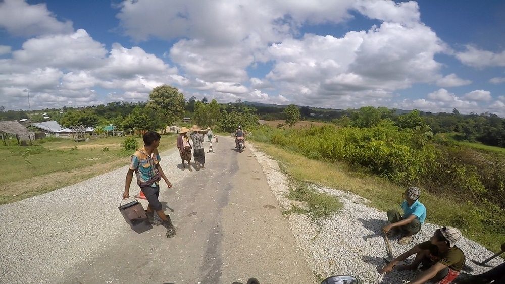
Being so sparsely populated, there are only a few real towns
in the state. In this episode, I travel between two of them which aren’t very
far apart: Hakka (the new capital) and Falam (the old capital).
Again, I was
taken in by the amazing mountain views I got to see and noticed a few things.
Chin burial customs involve roads. At almost every major turn in the road, at
almost every spot where you could look out and see spectacular vistas of
expansive mountains and valleys, there were graves.
Not graveyards, just
graves. Two or three, up to eight perhaps if it was remarkably beautiful spot.
And of course, memorials to the dead. Structures to preserve them from the
elements. It was kind of odd that at every point when I wanted to stop and take
a picture of the remarkable landscape, that I was doing so alongside someone’s
dead uncle, but I’m not superstitious in that regard. If there’s
life-after-death, ghosts, that sort of thing, I’d think any human soul would
appreciate what I was doing, and wouldn’t be offended if I needed to go pee on
the periphery of their gravesite.
Breakfast in Hakha
I got to Falam, a very religious town which I’ve heard
recently tried to ban alcohol sales within the town limits.
Having a nose for
these sorts of things, I found that this ban would involve shutting down one
shop, because it seemed there was only one place in town to get a beer.
While on holiday, it’s quite natural to refer back to being
at home, thinking to yourself, “I’ll do or get this or that when I’m home.” These
thoughts come even if it’s just a temporary home like staying with your parents
on holiday. When you live fulltime in an RV, as my parents do, there is no
getting back home after a holiday. You carry your home with you! A few times during
my time staying with my parents, I was confused by this basic fact.
That said, not every excursion requires driving your home
around.
You may have noticed in a previous video that my folks tow a jeep
behind their rig, and this comes in handy for getting around. Once
parked and settled there at Furnace Creek Campgrounds, we began exploring Death
Valley itself. My parents had been there several times. I’d only been once. It
was May 2007, and I just passed through the place at night on my way from
Yosemite to Las Vegas. Even at night, I remember the heat being terrible. The
oppressive atmosphere and haze seemed unwelcoming, and I understood why the place was called what it was. Well, that was in May. In December, the place is quite different. Pleasantly cool in the morning, nowhere near hot in the daytime, we'd definitely picked the best time of year to visit.
Come with us as we check out the sights by watching the video below.
I woke early on the 10th day of the journey to the sound of gardeners outside my window tidying up the grounds of the Mountain View Resort in Tomohon.
This was on the wall of the hotel where I
spent my first night in Manado. Maybe it
planted a seed in my head.
Looking forward to a full day of sightseeing, I opened the door of my bungalow and sniffed the cool highland air. Glancing the gardeners, I was surprised. They were an older Western couple. White people doing the groundskeeping in a place where the minimum wage was about $5/day. It was the hotel manager and his wife, diligently weeding and raking up leaves.
This was one of three accommodations I stayed at on the trip run by foreigners. Seeing them has put an idea in my head, perhaps I dare call it a dream.
From the Mountain View Resort
I got 20 years of teaching in me still, and I've got no idea what I'll do in retirement. I can picture myself raking leaves at Joko's Inn, opening up somewhere in SE Asia in 2035. Obviously, this would take a lot of resources, and I've got no idea what goes into opening and running a hotel other than what I've gleamed from being an avid traveler these last few years. Anyways, just floating an idea... perhaps I'll make it into a goal.
What to see and do in Tomohon? The first place to visit was the central market in the heart of the city. I'd read online that there were quite some unusual foods being sold there. I wasn't looking forward to seeing dogs on the butcher block again, but the idea of eating bat intrigued me.
wings sold separately
After visiting the market, it was a pleasant ride up the green slopes of the Mahawu Volcano. The volcano's crater was within a well tended national park, and I was expecting a significant foreigner entrance fee. I signed their guest book and was asked to make a donation of whatever I felt like making. That was refreshing.
The video just covers the morning's activities there in Tomohon; what happened on the way back from the volcano gets its own video.
Refreshed as I was having reached the south coast, I was ready the next morning for the next stage of the journey. I had spoken with the owner of a beachside cafe who happened to be a German very much into motorcycle touring there in Java and had gotten some good insights into the roads ahead. He told me that the road to Ujung Genteng was quite good and that I would have a swift and easy ride.
The Hotel cat saw me off
At 94 kilometers, it was the shortest leg of the journey, and the German was right. The road was fantastic. Curvy, but not one hairpin turn after another. Smooth and uncrowded. Spectacular scenery all around. It's roads like this which are why I enjoy motorcycle touring the first place. Furthermore, to have as a destination the beautiful beach at Ujung Genteng, that made it even that much better.
The hills of West Java (slightly color enhanced)
The road to the hotel
I found and booked the hotel I chose in Ujung Genteng online. In some respects, I enjoy the certainty of knowing where I'm going when I end the day on the motorbike. What I've come to realize, however, is that it's often better not to book online until you've seen the place. I didn't like my hotel that much. The road to get there was terrible, and really, it was meant for those who were there for the tremendous surfing a few hundred meters away at the beach.
Still, a beautiful sunset is the same no matter where you're sleeping.
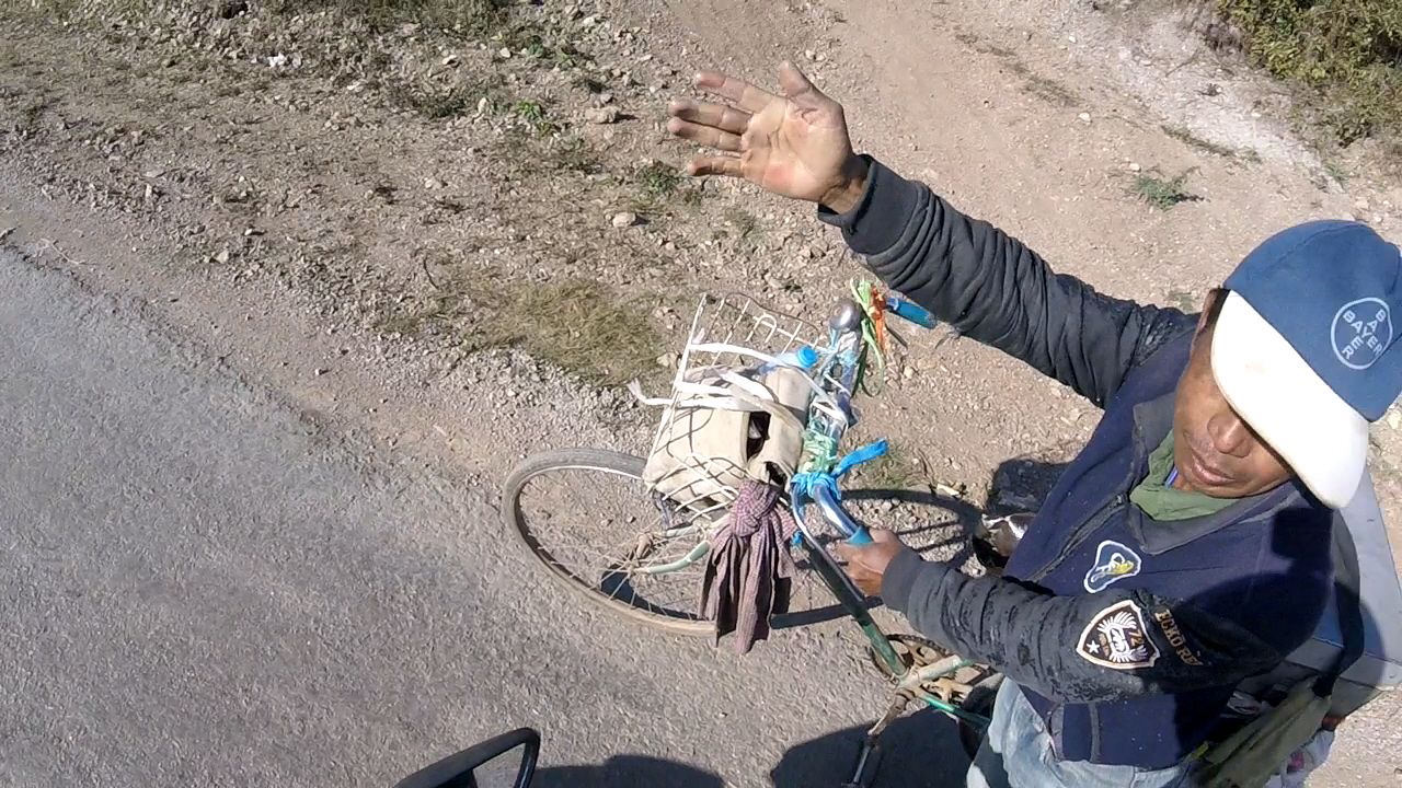
I'm learning to drive like a Myanmar person. There are certain
behaviors on the road that used to baffle and sometimes infuriate me
regarding how people drive here. Now, I've come to accept and expect
them.
For example, when a driver is entering traffic from a
perpendicular side street on your right onto the road you're on, they
never, ever look left to see oncoming traffic; they just make a
right onto your road without even considering who might be barreling
along into their path. It used to bug me a lot. Now, when I see
someone approaching the highway I'm on from the right, I just assume
they're going to pull on without looking and I adjust accordingly.
Heck, even I'm starting to do it! I just pull onto the road as I've
got the right-of-way, no thoughts as to what's coming down the road.
This is why Asians have gotten the reputation for being such bad
drivers back in the West. In actuality, they just play by a different
set of rules.
It was Christmas Eve morning as I set out from Kalaw to
Nyaungshwe, the principal town on the shores of the famous Inle Lake.
My memories of Kalaw will be that of being very, very cold. Sure, it
was only 50-something Fahrenheit, but it was like a San Francisco
cold: bone chilling. Pretty town. I'd like to go back there in April
in the heat of Myanmar's summer. As the trip to Inle was a short one,
the shortest of the whole trip, I took a sidetrip down Myanmay Hwy 54
and found yet another amazing cave with lots of Buddha
Go that way!
images. This
cave was much more impressive geologically, if not religiously than
the similar cave I had visited in Kalaw.
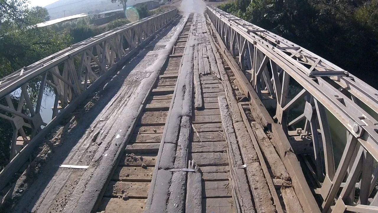
These wooden bridges are troublesome too
The road out of Kalaw was fine. Well paved and not too much
traffic. Thing is though, it was mostly downhill. I suppose it's the
same for a car, but as any motorcycle rider who's driven through
mountains knows, it's far easier and fun to go uphill than downhill.
When going uphill, you can accelerate into the turns, power though
them; there's no question of going too fast. When going downhill,
it's a mix of downshifting and braking, all the while holding
yourself back from the handlebars. It's tough. So, the small 60 km
jaunt I talk about was a little harder than I'd thought it would be.
When I got to Inle, I got in a dust up with some guys demanding an 'entrance fee' because I was a foreigner. I didn't get it on video, but I do rant about it in the voice over.
A couple hours after I got Nyaungshwe, so did my friend Dean, who traveled there from Nay Pyi Taw just to hang out with me.
Enjoy the video.
Road Report:
Distance: 60 km
Travel time: 2 hours (not including sight-seeing detours)
Road Conditions (see the key): Good 60%; Fair 40%
I've been hooked on motorcycle touring ever since I was in Thailand. Riding a motorbike through the roads of a developing country can be tiring at times. Perhaps even a little dangerous. It's worth it. Getting away from where the foreigners usually are allows me to see the country more as it really is, as opposed to how it's presented.
As I've said before, having the motorbike has been the best part of moving to Naypyitaw; motorcycles are banned from the city streets of Yangon. My travel companion Chris and I were planning our first multi-day journey. The goal was to visit Taungdwingyi, a small city about 100 miles west of Naypyitaw, visit the ruins of 2000 year-old city called Beikthano, get a hotel there and then drive back via a different route the next day.
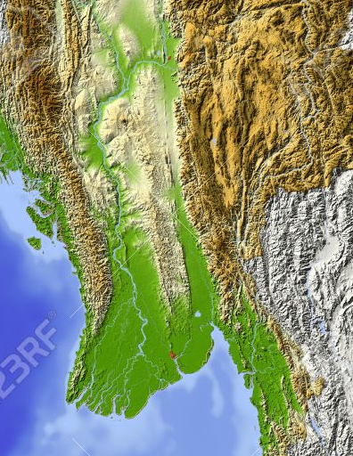
I was interested in the ruins, but the real thrill was going to be the drive itself. You can see the route we'd planned on the map above, but let me expand on it by explaining a bit about the geography of Myanmar. As you can see on the topographic map, the country is bounded on either side by tall mountain ranges.
The center of
the country is a big valley, but the lowlands themselves are split down the middle by a range of hills. They're not that tall, but we were expecting them to be scenic. Naypyitaw sits in the eastern half of the valley. Taungdwingyi is just on the other side of the hills in the western half, the Ayerwaddy River valley. The cool thing about this trip was that we had a boundary to cross; an obstacle to overcome.
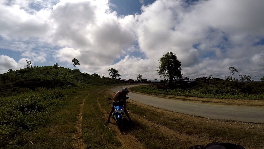
We left early in the morning and as soon as we got out of the sprawling metro Naypyitaw area, the beauty, the intense greenness all around, and eventually, the rolling contours of the Bago Hills just had us smiling ear to ear. This is why we're here: to explore a new country.
The people we passed, sat with in tea shops and interacted with were very curious about us. Full of smiles and often dumbstruck when we appeared, this was obviously just as new for them as it was for us. If you think about it, Myanmar has been closed to outsiders for 45 years before opening up in 2010. Up here in the capital, most of the foreigners here are older than Chris and even I, so on the whole, they're not the kind who go out and adventure. Our Taungdwingyi Loop certainly isn't on any tourist guidebook or website. Despite being close to a
Was that a caucasian driving by?
UNESCO World Heritage Site (the Beikthona ruins), Taungdwingyi doesn't have a page on Witkitravel.org, isn't mentioned at all on TripAdvisor or Lonely Planet. Even go-myanmar.com ignores it. It's certainly within the realm of possibility that we were the first westerners the hill-dwelling locals had ever seen in their entire lives.
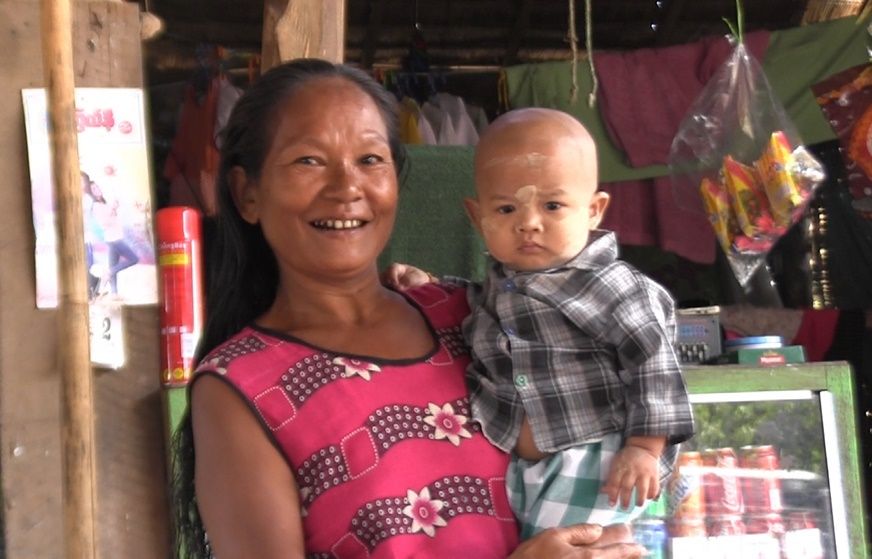
Myanmar is a nation of lots of different ethnic groups. One of the largest is the Karen people who mostly live in the mountains on the east side of the country as well across the border in Thailand. I found it interesting that I noticed lots of Karen-style costumes on the people of these hills. After looking at a map of the ethnic groups of Myanmar, I saw that these hills west of Naypyitaw are inhabited by Burmo-Karen people, i.e., a mixed ethnicity. The woman in the picture above has very Karen-like facial features, but her grandson is wearing thannaka, a wood-based facial sunscreen that is traditionaly Burmese.
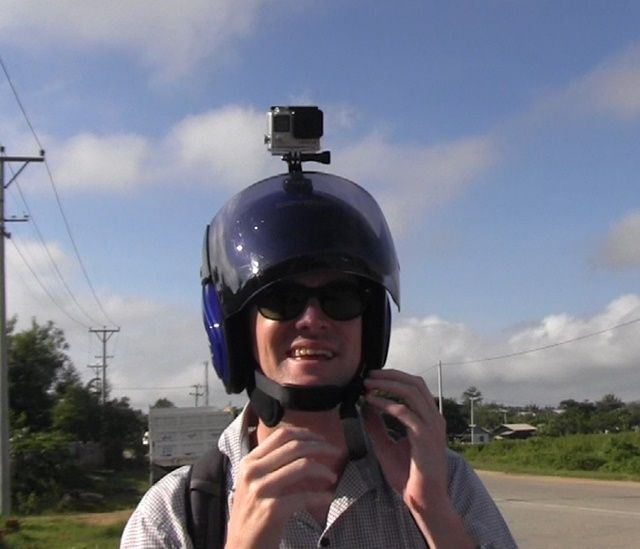
My friend Chris had recently purchased a new toy: a GoPro video camera. These miniature cameras record in HD, are rugged and durable and come with a variety of accessories that allow you to do things like attach it to the top of a motorcycle helmet. I so want one.
The video I made uses clips from my camera as well as new perspectives made possible by the GoPro. I'll share some screen grabs before the video. Please watch and comment on YouTube!
The Bago Hills had a big sky.
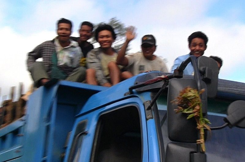
Getting to ride on the top of a truck and seeing foreign tourists in your area for the first time makes for a happy occurrence.
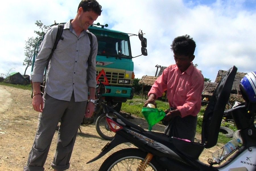
We filled up three times on our journey. Up in the hills, this is a gas station.
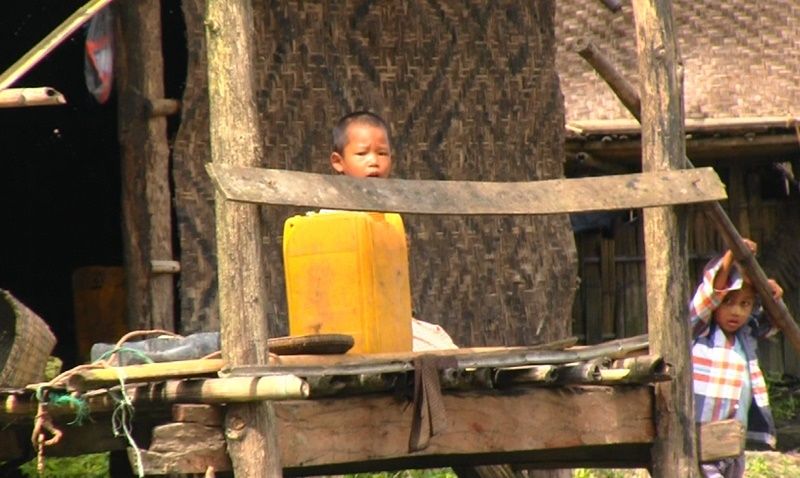
Funny framing on this one. Toddlers now available in convenient plastic containers!
Rush Hour on Myanmar's Highway 2.
The gas pumping committee.
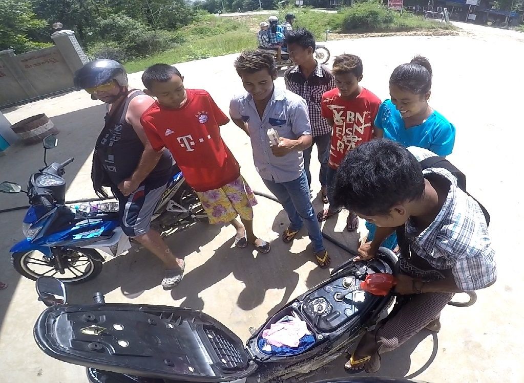
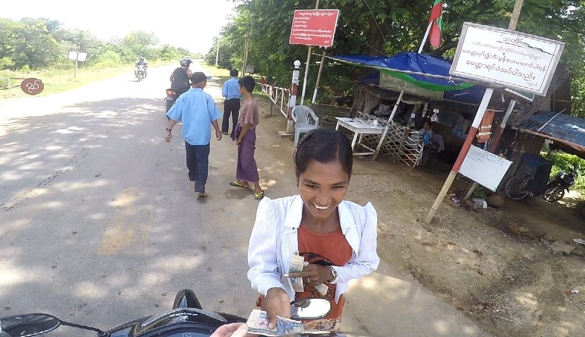
A lovely young lady whose job was to collect the toll for the road to Taungdwingyi. Mind you, the toll was 100 Kyats, i.e., 8 cents.
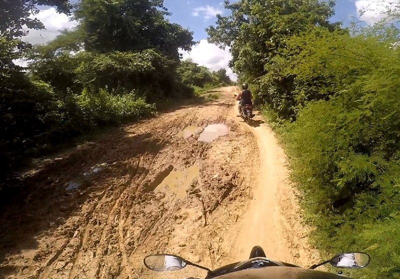
I was worried about the roads, this being the tail end of the rainy season. We've been foiled by ruds-turned-to-mud before. There was only one small stretch of that on the journey to Taungdwingyi.