Monday, January 11, 2016

Myanmar Motorcycle Journey 8 - Loikaw to Taungoo

These tractor-buses putt along at about 5 mph
I was very nervous beginning this next part of my journey. My goal for the next three days was Loikaw-->Taungoo--> Pyay-->Toungup. I was beginning a stretch where I'd be going from the far eastern part of Myanmar all the way to it's west coast. Crossing the entire country, about 500 miles, with three mountain ranges in the way.

It wasn't that long ago (2014) that me even attempting this would have been forbidden by the government. Most of Myanmar was closed off to foreigners, either entirely or requiring special permits to enter. This was ostensibly to protect visitors as there's many armed ethnic insurgent groups throughout the country. There still are, but only a few places have active conflicts. There are still a few places I'd need special permission to enter. In my research to find out where, I came across this outfit, Mandalay Motorcycle Rental and Tours. I wrote them, and they told me that as I hold a Myanmar Drivers License, I could go to all these places without need of permits. Other tourists who are here temporarily do need permits unless they're part of a tour group. So, if anyone reading this wants to try something like what I've done, contact Zach at mandalaymotorbike.com and join one of his tours.


Be careful coming around corners. You never
know what might be in the road ahead.
They also told me they had recently made the Loikaw-Taungoo trek and that the road was very long and very rough. This warning added to my consternation, but at the same time, eased my mind in that I knew it could be done.  During previous stages, I had taken side trips to see sites along the way. For this stage, I only had time for one, the Seven Stages Lake in Kayah State. Be-yoooo-tiful!

This is a road
The roads coming out of Kayah State weren't actually that bad, but I crossed over into the furthest north part of Kayin State, yeah, parts of "Old Road" were torture. Really, really difficult roads. Bone jarring. Another thing I noticed that was different on the western slopes of the mountains was the forested countryside. If you've watched the previous videos, you may have judged Myanmar to be a pretty dry place. We are in the midst of the dry season, and most of these places haven't had any rain in 6 weeks or more. About halfway through the trip, the forest turned to jungle. It felt like a tropical rain forest, which I suppose is what was!

I was so relieved as the hills flattened out and I found myself again in the Bago Valley. The drive took 8 hours, and I rewarded myself with a hamburger at Taungoo's finest hotel (not where I stayed).

Enjoy the video, once again with all-ukulele background music!

Friday, January 8, 2016

Myanmar Motorcycle Journey 7 - Pinlaung to Loikaw


Cold. Oh, I was so cold. I thought I had been cold a few days previous, up in Kalaw, but this was a kind of coldness I had not experienced since leaving America.  I should point out that the town I was leaving, Pinlaung, has an elevation of 4800 feet (1460m). The temperature on the thermometer was all of 55F (13C), but I was moving on my motorbike, the air was thick with fog, and the sun had not yet risen over the ridge of the mountains. And I was wearing shorts. I didn't bring pants with me on the journey. Now, Pinlaung to Loikaw was another short stage, only 90km (55 miles); I could have just holed up in a tea house or someplace and waited it out until the air got warmer. No, with the help of some cold weather gear I bought along the way, I kept going.

In the town of Pekon, my breakfast was a bowl of Mohingga, the traditional Myanmar morning soup. My eyes and camera were open, looking for anything I could that I remembered from reading The Land a Green Ghosts, a remarkable and award-winning memoir by Pascal Khoo Thwe about growing up as a hill tribesman and the political upheaval in Myanmar in the late 80's and 90's. Much of the book is set in Pekon, and it was a real thrill for me to be visiting the town that had fascinated me so much in print. Literary tourism is a real thing, but it hasn't come to Pekon as of yet. There were no big signs saying "FORMER HOME OF PASCAL KHOO THWE THIS WAY!", but I did find one building mentioned quite a bit in the book, the town's main Catholic Church; most of the Padaung tribe are Catholic, not Buddhist.


Soon after leaving Pekon, I found myself in Loikaw, the capital of the state of Kayah. I found Loikaw to be a town of two halves. The north part of town had big, wide streets, sidewalks, landscaping, smooth flowing traffic and lots of beautiful buildings and monuments. Cross a one-lane bridge to the south part of town and you're in a crowded, chaotic, dusty Myanmar city.

As you'll see in the video, my activities in Loikaw included finding a hotel, visiting the amazing Taung Kwel Zaydi pagodas and having a dinner I'll never forget. Continuing the theme of my favorite ukulele music in the background, enjoy!


Road Report:
Distance: 89 km
Travel time: 3 hours
Road conditions (see the key): Excellent 2%, Good 83%, Fair 15%

Wednesday, January 6, 2016

Myanmar Motorcycle Journey 6 - Pinlaung

Christmas 2015 was rare in that it landed on a full moon. Well, at least that's what I thought as I stared into the clear skies of the Shan Hills. Sure looked like a fool moon. I imagine it's hard to pinpoint exactly which day the full moon falls. I mean, at the moment, it's one day here, but on the other side of the planet, it's still yesterday. There's probably some council of astronomers somewhere who make this decision.

The term "towel head" is a racial slur, but not against these
Shan women who literally wear towels on their heads.
So, actually, the full moon was on the 26th. As full moons are always holidays in Theraveda Buddhism, and the one for this month particularly so, I saw lots of celebrations and ceremonies on the roads of Myanmar as I made my way from Inle Lake to Pinlaung.


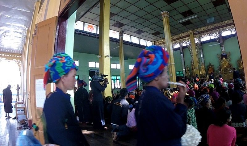
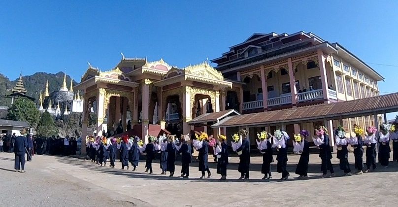
At the end of the video for Part 5 of this series, I ended it by showing a remarkable procession playing haunting, mystical music. What was the procession for? You'll see in the video.
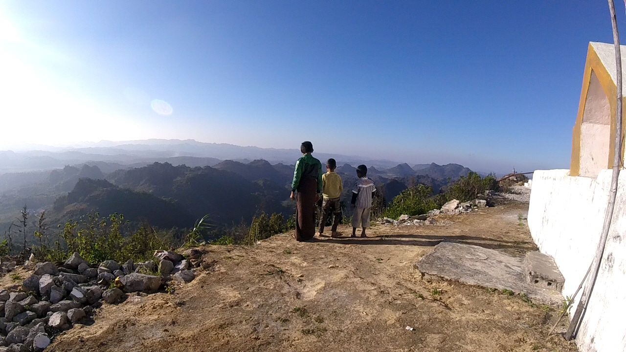
The best reason to visit Pinlaung is to go up to Loi Maung Taung Pagoda. The view from up there, wow, even the locals who go there every day to pray are amazed by the vistas. 
Local kids are just as impressed as anyone


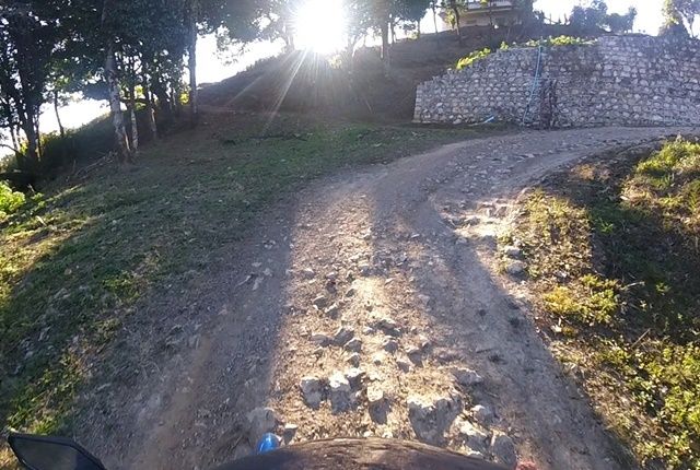
Near the top, the road becomes bad, but it so worth it. 


Another thing I did in Pinlaung is gather information. See, one of the scary parts about going there is that there was absolutely no tourist information about the place online whatsoever. No page in any travel guide. No reviews of any sort. My friend had told me there was a hotel, and as you saw, I found it just fine. One thing I am going to do now, however, is to create a Wikitravel (the travelers version of Wikipedia) page for the place. I found out about buses, trips up to the pagodas, I can review two restaurants there and as you'll see late in the video, I stopped at the other hotel in town to inquire about rates. I think of it as doing my good deed for the internet. 

Enjoy the video (have you noticed a theme in regards to the music?)


Monday, January 4, 2016

Myanmar Motorcycle Journey 5 - Nyaungshwe to Pinlaung

After two nights on the shores of Inle Lake, I was rested and ready for the next stage of the journey. We were treated nicely (got a free Christmas Dinner) by the folks at the Queen Inn (just across the canal near the bridge), so I said goodbye to them as well as my friend Dean, and I was back on the road.

As I skirted down the east coast of Inle Lake itself, I passed by several luxury resorts. $150-$200 per night type joints which I'm sure are quite lovely, but it got me thinking about how tourism is developing here in general, something I've though about quite a bit over the course of the entire journey.
I've had a lot on my mind, but not like this girl.
Seems to me like they're building way too many high-end accommodations and not enough mid-priced stuff. Why aren't there any affordable hotels on the lake? They're all up in the town of Nyaungshwe (connected to the lake by a canal). Why hasn't anyone opened a motorcycle rental shop in Nyaungshwe? Two sets of tourists asked me where I rented my bike. I understand the government here wants a controlled growth of their tourism industry, but I question the direction it's going.


Another example of this lop-sided development is the town of Nampan, a town almost as big as Nyaungshwe at the very southern end of the lake.  You'll see me make a detour into the town about 1 minute into the video. Before being joined by Dean, my plans included possibly staying a night in Lampan after visiting the ruins of Inn Dein the day before. I couldn't find any information for reasonable accommodations in Lampan, but I had been assured by others that there had to be a guesthouse or two. Look at the place. There's no guesthouses. In fact, it looked rather poverty strciken; an influx of tourist dollars certainly couldn't hurt the place.


Moooooove it!
South of Inle, the roads began to get hilly again, and I saw some remarkable stuff. Almost hit a cow. I do wonder who would get the worse of a cow-motorcycle collision.

There's a much larger lake a bit south of Inle, although this one is man-made, a product of the country's largest hydroelectric dam. I was admiring it's growing width in the valley below me, and eventually (after about 12 miles of looking at it), it occurred to me: The lake is on the wrong side! If I could see it at all, it should be on my left! Oh well. First time getting lost. I blame Google Maps. They showed the road I was on as ending at the point where I needed to turn right up towards Pinlaung. It didn't end.  

The geology got more and more interesting.


I'm always fascinated by Buddhists monks on motorcycles. 

Finally, I got to Pinlaung which I'll write about more in the next blog


And enjoy the video...


Road Report:
Distance traveled: 95 km (was supposed to be 60)
Time: 3.5 hours
Conditions (see the key): Good 35%; fair 60%; bad 5%

Myanmar Road Conditions: The Key

In my blogs about traveling through Myanmar, I try to give a road condition report, as I think this is useful to others who might want to travel the same way I have in the future. Here's a key to the terms I use to describe Myanmar roads:

Excellent - Perfectly smooth, world class, multi-lane highway.

Good - Speed not impeded in any way by road conditions. You can drive as fast as you want. Generally 2-lane, but with plenty of space to allow even the biggest trucks to drive by each other without worry.

Fair - Bumpy. Slows down how fast you could go by a significant amount. Keeps you on your toes as, while driving, you have to swerve around big pot holes in the road, as well as dogs, cows, tractors, water buffalo, toddlers, rocks and ox carts. Be very careful to hug the edge of the road as buses pass from the other direction. Passing a slow truck can be a challenge.  This can also include otherwise smooth and wide paved roads, but which are covered in a layer of fine gravel. The little rocks are better for cars and trucks, but suck for motorcyclists.

Bad - Extremely bumpy. It's as if someone had stripped away a road and just left rocks. Speed tremendously limited. This can also include unpaved roads. You may be forced onto the shoulder (if there is one) when trucks come the other way. Often, the shoulder is in better shape than the road.

ARRRGH! - Travel reduced to walking speed and you're stuck in second gear. Torture on wheels.  ARRRGH! conditions are often created by roadwork itself, improving a bad road. In the interim, the motorist has to drive on a bed of rocks.

Saturday, January 2, 2016

Myanmar Motorcycle Journey 4: Inle Lake

Inle Lake is one of the “Big Three” of places to see if you're a tourist in Myanmar, the other two being Bagan and Mandalay. Up until this week, I had been to none of these places. I'd heard good and bad things about Inle, but one thing for sure that I had determined is that I was not going to have a 'typical' tourist experience there.


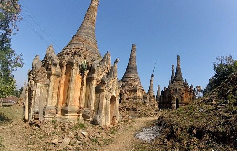
About a year ago, I read this article on the internet  . Ooo... It described a place near Inle, accessible only by river that even the locals didn't visit. Filled with ancient pagodas slowly being eaten up by the surrounding jungle. How fascinating! So, my goal early on was to visit Inn Dein, the site of these ruins. Eventually, as my plans included my friend Dean who took a bus from Naypyitaw to meet me there, we decided to see the lake on a beeline to Inn Dein.


As you'll see in the video, Inn Dein was anything but what was described in the article. It wasn't some remote, unvisited, forgotten temple complex. It was filled with tourists! So be it. It was still an incredible experience to see these stupas in their state and imagine what it was like 500 years ago when they were new. Inle Lake and its surroundings had been the center of power for the various tribes of the Shan people. I was in Shan State, and the people there are not Burmese, in that the word “Burmese” derives from the word “Bamar”, the dominant ethnic group in the rest of the country. Shan people are actually more connected ethnographically to the Thai than the Bamar.

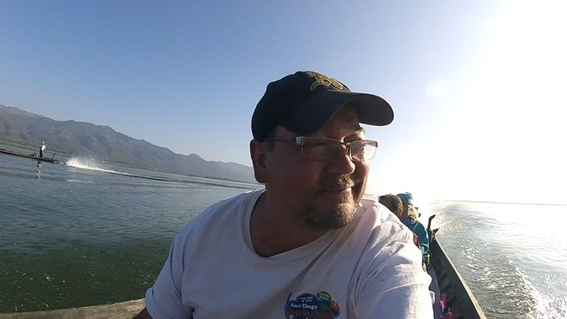
But I digress. Inle Lake was magical. It kind of reminded me of Lake Tahoe in California in that it was a natural lake high up in the mountains surrounded by hills. Moreover, I heard strange, magical music. Hearing noises that aren't there isn't a great attestation to one's mental health, but I'm admitting it anyways. Over the roar of the boat's engines, I heard a haunting, delicate and subtle melody that kept kept changing unpredictably, as does all Myanmar music. It sounded like it was coming out of some kind of pipe instrument. I only heard when the boat engine was roaring. None of my travel companions heard it. It was probably just some kind of auditory hallucination, but I'll chalk it up to the power of this long revered holy place.

All in all, I really enjoyed this 'rest day' (I didn't drive anywhere) in Inle. The food was amazing, I got to see what I wanted to see and got to experience what makes this place what it is. 


Friday, January 1, 2016

Kalaw to Nyaungshwe: Myanmar Mototcycle Journey 3

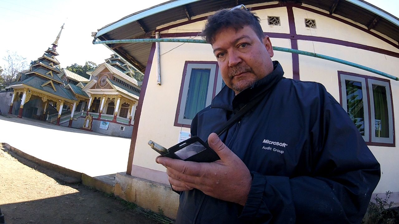
Your humble blogger
I'm learning to drive like a Myanmar person. There are certain behaviors on the road that used to baffle and sometimes infuriate me regarding how people drive here. Now, I've come to accept and expect them.

For example, when a driver is entering traffic from a perpendicular side street on your right onto the road you're on, they never, ever look left to see oncoming traffic; they just make a right onto your road without even considering who might be barreling along into their path. It used to bug me a lot. Now, when I see someone approaching the highway I'm on from the right, I just assume they're going to pull on without looking and I adjust accordingly. Heck, even I'm starting to do it! I just pull onto the road as I've got the right-of-way, no thoughts as to what's coming down the road.

This is why Asians have gotten the reputation for being such bad drivers back in the West. In actuality, they just play by a different set of rules.

It was Christmas Eve morning as I set out from Kalaw to Nyaungshwe, the principal town on the shores of the famous Inle Lake. My memories of Kalaw will be that of being very, very cold. Sure, it was only 50-something Fahrenheit, but it was like a San Francisco cold: bone chilling. Pretty town. I'd like to go back there in April in the heat of Myanmar's summer. As the trip to Inle was a short one, the shortest of the whole trip, I took a sidetrip down Myanmay Hwy 54 and found yet another amazing cave with lots of Buddha
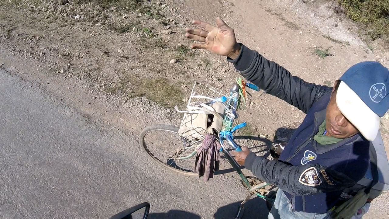
Go that way!
images. This cave was much more impressive geologically, if not religiously than the similar cave I had visited in Kalaw.
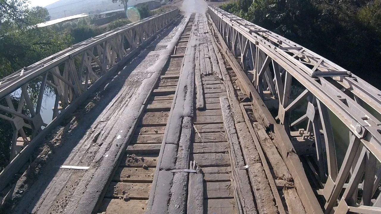
These wooden bridges are troublesome too
The road out of Kalaw was fine. Well paved and not too much traffic. Thing is though, it was mostly downhill. I suppose it's the same for a car, but as any motorcycle rider who's driven through mountains knows, it's far easier and fun to go uphill than downhill. When going uphill, you can accelerate into the turns, power though them; there's no question of going too fast. When going downhill, it's a mix of downshifting and braking, all the while holding yourself back from the handlebars. It's tough. So, the small 60 km jaunt I talk about was a little harder than I'd thought it would be.

When I got to Inle, I got in a dust up with some guys demanding an 'entrance fee' because I was a foreigner. I didn't get it on video, but I do rant about it in the voice over.

A couple hours after I got Nyaungshwe, so did my friend Dean, who traveled there from Nay Pyi Taw just to hang out with me.

Enjoy the video.


Road Report:
Distance: 60 km
Travel time: 2 hours (not including sight-seeing detours)
Road Conditions (see the key): Good 60%; Fair 40%

Test Survey